Third Edition of I SEE GEOMATICS
TIMELINE GEOMATICS!
ARTIFICIAL INTELLIGENCE ROLE & CLIMATE CHANGE IMPACT
30th October -1st November 2023 - Hammamet - TUNISIA
Organization
About the Organizers
The Tunisian Association of Geomatic (ATG) is in partnership with the Research Laboratories of Engineering Geotechnics and Georisk (LRIGG) in ENIT. In addition, the University of Tunis El Manar (UTM), and High school of Engineering of Tunis (ENIT) are pleased to organize the third International Congress of I SEE GEOMATICS 2023, from 30th October to 1st November 2023 in Hammamet-Tunisia
In Cooperation with
Be wireless, Sahara and Sahel Observatory OSS, LACEEDE laboratory, CRISTAL Laboratory, Société de Topographie Cartographie et de Bathymétrie Topo+, Centre National de la cartographie et de la Télédétection CNCT, Association Marocaine des Jeunes Geomaticien AMJG, Palais des Sciences de Monastir PSM, The Global Monitoring for Environment and Security and Africa GMES, Agence Universitaire de la Francophonie AUF, The Deutsche Gesellschaft für Internationale Zusammenarbeit GIZ, Institut Sylvo-Pastoral de Tabarka ISPT, Tunisian Digital Imagery Surveys TDIS, Faculté des Sciences de Tunis FST, Urban Planning & Development URBATOP, Geomatics & Topography Engineer SM, Ecole Nationale d’Architecture et d’Urbanisme de Tunis ENAU, Agence d’Urbanisme du Grand Tunis AUGT, Agence de Réhabilitation et de Rénovation Urbaine ARRU, Mairie de la Goulette, Office National des Mines ONM, Office de la Topographie et du Cadastre OTC, Ecole de l’Aviation de Borj el’Amri, Institut National de la Recherche Agronomique de Tunisie INRAT, Institut National de la Recherche en Génie Rural, Eaux et Forêts INRGREF, Centre de Recherches et des Technologies des Eaux Technopôle Borj Cedria CERTE, Laboratoire Eau, Energie et Environnement EEE, U-Accelerator, Tunisian Entrepreneurship & Spin-off Association ATUPEE, RIADI Lab, Laboratoire de Géoressources LGR, L’Ecole Supérieure Privée de l’Aéronautique et des Technologies ESAT University, SuperMap Software Co, Office of topographical studies and geomatics engineering TOPGEO, Regional Center for Remote Sensing of North Africa States CRTEAN.
Aim and Objectives
I SEE GEOMATICS 2023 will bring together researchers, research scholars, experts, and policy makers to share their research, and experiences and discuss recent advances in Geomatics Methods and applications to social, cultural Heritage city, Georisk, Energy, Georessources, and new Geomatic Industry Surveys. The conference will cover many aspects related to Modeling with Intelligent Systems applications grouped into three main topics below.
Indeed, the colloquium will provide a space to discuss the results of the digital Web mapping research thematic and fundamental applications. It will also offer the opportunity for a national and international debate of experts:
- To emphasize the Public, Private, ad NGO Partnership and
- To develop new incoming works on AI methods and applications, with consideration of climate change impact, and broadcasting of the Copernicus Geospatial data for the wide public « OPEN DATA ».
Conference Venue
The I SEE GEOMATICS 2023 will take place in Hammamet, a coastal city located in the Northeast of Tunisia.
The town is very famous for its fordless white sandy beach and tourist resort.
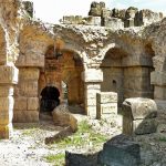
At the city center stand the old Medina and the historic fort of Hammamet
Internationally distinguished keynote speakers
With the presence of internationally distinguished keynote speakers: Michel Boko (Benin), Faouzi Ghorbel (Tunisia). Pierre Grussenmeyer (France), Michel Kasser (Suisse), Yacine Bouroubi (Canada).
Conference topics
GEOMATICS and AI.
- Smart solutions for sustainable water, soil and air management
- Geospatial data for Sustainable Development of agricultural resources.
- Assessment Approaches for land use, land cover (Agrogeomatic)
- Monitoring environment and climate changes indicators
- Natural Resources and Environment management
SPATIOTEMPORAL MONITORING AND 3D MAPPING
- Real Time monitoring and embedded system
- 3D Survey and Mapping
- Geodesign and Urban 3D
- Optimisions Solar land Modelling
- BIM, Sustainable Development
HERITAGE AGAINST CLIMATE CHANGE
- Geomatics and Augmented reality
- Climate change Impact on heritage
- Digital photogrammetry and rebuilding monument
- Revisited Tourism
- WEB – GIS applications
- Topic 1
-
GEOMATICS and AI.
- Smart solutions for sustainable water, soil and air management
- Geospatial data for Sustainable Development of agricultural resources.
- Assessment Approaches for land use, land cover (Agrogeomatic)
- Monitoring environment and climate changes indicators
- Natural Resources and Environment management
- Topic 2
-
SPATIOTEMPORAL MONITORING AND 3D MAPPING
- Real Time monitoring and embedded system
- 3D Survey and Mapping
- Geodesign and Urban 3D
- Optimisions Solar land Modelling
- BIM, Sustainable Development
- Topic 3
-
HERITAGE AGAINST CLIMATE CHANGE
- Geomatics and Augmented reality
- Climate change Impact on heritage
- Digital photogrammetry and rebuilding monument
- Revisited Tourism
- WEB – GIS applications
Hackathon
Rise to the challenges of climate change through AI for sustainable development
The AI Hackathon on the Climate Crisis is a 48-hour event which included trainings in problem solving through design thinking, business model innovation and coaching sessions to further validate participants’ ideas and prepare the pitch to address the challenge through innovation aimed at addressing relevant UN SDIs such as climate action and affordable and clean energy.
Using AI, our goal is to help solve climate change issues and create positive impact within 48 hours.
It will bring together beginners and experts who will tackle climate change issues using AI.
-
Rise to the challenges of climate change through AI for sustainable development
The AI Hackathon on the Climate Crisis is a 48-hour event which included trainings in problem solving through design thinking, business model innovation and coaching sessions to further validate participants’ ideas and prepare the pitch to address the challenge through innovation aimed at addressing relevant UN SDIs such as climate action and affordable and clean energy.
Using AI, our goal is to help solve climate change issues and create positive impact within 48 hours.It will bring together beginners and experts who will tackle climate change issues using AI.
Data Visualization Challenge
A dataset will be provided and participants will be required to build a visualization tool to help researchers better visualize the data and use it for their analysis
Climate Change Impacts
Using climate change projection data, participants will explore potential human and environmental impacts
Define problems and solutions
- Challenge 1
-
Data Visualization Challenge
A dataset will be provided and participants will be required to build a visualization tool to help researchers better visualize the data and use it for their analysis
- Challenge 2
-
Climate Change Impacts
Using climate change projection data, participants will explore potential human and environmental impacts
- Challenge 3
-
Define problems and solutions
Participants, regardless of experience level, will have the opportunity to define their own problem and their own solutions. The main expected results will be a pitch deck. It is also possible to provide a proof of concept.
